Dangerous Wonder
A Field Guide to Everything Worth Knowing
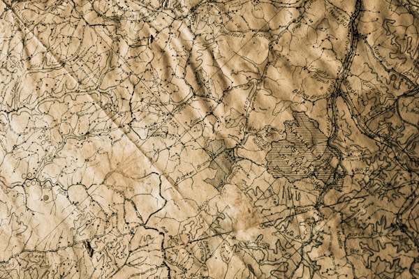
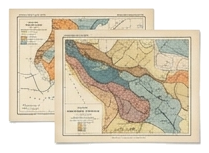
Maps & Places
Real and imagined geographies, faraway lands
Cartography is among the oldest of human ambitions. Long before we could write, we drew maps — scratched into bone, painted onto cave walls, pressed into clay tablets. To map the world is to claim understanding of it, to impose order on the terrifying vastness. But every map is also a lie. It is a selection, an interpretation, a set of choices about what to include and what to leave out. The history of map-making is the history of how we have chosen to see ourselves — and how we have chosen to see the unknown.
A map is a conversation between what we know and what we fear. (Photograph by Unsplash)
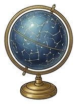
Here Be Dragons

A Renaissance-era globe: half knowledge, half imagination.
The phrase "Here be dragons" — hic sunt dracones in Latin — is one of cartography's most enduring legends. The idea that medieval map-makers scrawled warnings across uncharted territories has captured imaginations for centuries. The reality is almost more interesting: only two surviving maps actually contain the phrase. The Hunt-Lenox Globe, dating to around 1508, is one of them — its dragons sit just off the eastern coast of Asia, in a place where European knowledge simply ran out.
But while the exact words are rare, the practice was common. Medieval and Renaissance cartographers filled blank spaces with all manner of terrors: sea serpents, krakens, leviathans, grotesque humanoid figures, and strange hybrid beasts. Some of these were decorative whimsy. Others were genuine warnings — not about mythical creatures, but about the limits of knowledge itself. To venture beyond the edge of the map was to enter a space where the rules of the known world no longer applied.
The blank spaces on maps served another purpose: they were an admission of ignorance. In an age when knowledge was power, leaving a region empty on a map was an act of humility — or, depending on your perspective, an invitation. Explorers read those blank spaces as challenges. Monarchs read them as opportunities. The dragons on the map were not just obstacles — they were destinations.
Terra Incognita
Terra incognita — unknown land. The phrase appears again and again on maps from the 15th through 18th centuries, marking the boundaries of European understanding. These were not empty spaces; they were spaces filled with possibility. Every terra incognita on a map was a question asked in ink: What is there? Who lives there? What grows, what shines, what breathes in the places we have not yet reached?
Perhaps the most remarkable thing about terra incognita is how it has never truly disappeared. Today, our maps are satellite-verified down to the metre, and yet enormous portions of the world remain fundamentally unknown — not because we cannot see them, but because we have not truly explored them. More of the surface of Venus has been mapped at high resolution than the floor of our own oceans. We have mapped more of Mars's surface at high resolution than our own ocean floor.
The unknown has simply moved. It is underfoot, or inside us, or in the micro-ecologies of a single square centimetre of forest soil. Geography, it turns out, is not a finite problem.
The Mercator Projection & the Lies We Accept

The real Earth: a sphere that no flat map can truly represent.
In 1569, the Flemish cartographer Gerardus Mercator unveiled a map that would shape how humanity saw the world for the next five centuries. His projection was designed for a specific and practical purpose: navigation at sea. By preserving rhumb lines — paths of constant compass bearing — as straight lines, Mercator made it possible for sailors to plot courses with a ruler and a compass. It was a triumph of utility.
It was also a profound distortion. Because the Earth is a sphere and a map is flat, something must always give. Mercator chose to preserve shape and direction at the expense of area. The result: landmasses near the poles appear vastly larger than they truly are. Greenland, on a Mercator map, looks roughly the size of Africa. In reality, Africa is fourteen times larger than Greenland. Russia looms enormous. Europe sits prominently at the centre-top, as if the world were arranged for its convenience.
The Mercator projection has been criticised as a tool of Eurocentrism — and rightly so. But it is also a reminder that every act of representation involves choices, and those choices carry consequences. The map we see shapes the world we imagine. For nearly two centuries, children have grown up looking at a map that tells them, silently and persistently, that the northern hemisphere is larger, more important, and more central than it truly is. The map is always a mirror. What does yours reflect?
Other Projections, Other Truths
The Gall-Peters projection, which preserves area at the expense of shape, was adopted by some schools and institutions in the 1970s as a corrective — though its elongated continents drew their own complaints. The Mollweide projection offers an equal-area compromise shaped like an ellipse. The Waterman butterfly projection cuts the globe into a shape reminiscent of its namesake insect. Each projection is a different argument about what matters most.
 Did You Know?
On a standard Mercator projection, Antarctica appears absurdly vast. In reality, it is larger than the United States and Mexico combined. Meanwhile, Algeria — which on Mercator looks roughly the size of Greenland — is in reality more than four times larger than Greenland. The map in your school classroom was lying to you, and it probably still is.

Phantom Islands: Places That Never Were
For centuries, map-makers included islands that did not exist — and not as imaginative decoration, but as earnest assertions of fact. Sailors reported them. Captains charted them. Nations claimed them. Only gradually, sometimes over hundreds of years, did the truth emerge: these places were phantoms.
Frisland
Perhaps the most spectacular phantom island in cartographic history, Frisland appeared on maps beginning in the 1550s, supposedly located south of Iceland and west of the Faroe Islands. It was depicted in remarkable detail — with coastlines, mountains, and names of towns and harbours — on maps by some of the most respected cartographers of the age, including Mercator himself. For nearly a century, it appeared on virtually every map of the North Atlantic. The island almost certainly originated from a misidentification of the Faroe Islands by the Venetian navigator Nicolò Zeno, whose 1558 account of a voyage to the north Atlantic was later revealed to be a fabrication — but not before Frisland had been enshrined on dozens of maps.
Hy-Brasil
Hy-Brasil — sometimes simply called Brasil, long before the South American nation took the name — appeared on nautical charts from the 14th century onward as a small, circular island in the Atlantic, roughly west of Ireland. According to Irish mythology, it was shrouded in mist and visible only once every seven years. Despite its mythological origins, it appeared on serious sea charts for over five centuries. Expeditions were sent to find it. In 1497, the Spanish ambassador to England reported its discovery. As late as 1865, a community off the coast of Ireland was still called Brasil on local maps.
Other Vanished Lands
Frisland and Hy-Brasil are merely the most famous of a whole archipelago of phantom islands. Sandy Island, near New Caledonia, appeared on maps and even on Google Earth until 2012, when an Australian research vessel sailed to its coordinates and found nothing but open ocean. Bermeja, an island off the Yucatán Peninsula, was marked on maps from the 16th century until 2009, when a thorough survey confirmed it had never existed — an awkward discovery, since its existence had affected Mexico's maritime boundary claims.

Phantom Islands of Note
- Frisland — Detailed phantom island south of Iceland; on maps from the 1550s to the 1660s.
- Hy-Brasil — Mythical island west of Ireland; charted for over 500 years.
- Sandy Island — Appeared on maps and Google Earth until erased in 2012.
- Bermeja — Off the Yucatán coast; removed from maps in 2009.
- Peñón de Vélez de la Gomera — Once mapped as much larger than its reality (a tiny tidal island).
- Pepys Island — A phantom island in the South Atlantic, shown on maps from the 17th to 19th centuries. Searches in 1825 and later found only open ocean.
The Most Remote Place on Earth
In the middle of the South Atlantic Ocean, approximately 1,500 miles from the nearest continent, there exists a small volcanic island group called Tristan da Cunha. It is the most remote inhabited archipelago in the world. There is no airport. The only way to reach it is by ship — a journey of roughly six days from South Africa, and even then, the harbour is so treacherous that ships can often not land.
Approximately 250 people live on the main island, nearly all of them descended from seven original settlers. The village, called Edinburgh of the Seven Seas, has one school, one small supermarket, one pub, and one doctor. The islanders speak a distinctive dialect of English that has evolved in isolation for nearly two hundred years. Cars are few. Internet connections are slow. The nearest neighbour is the island of St. Helena — Napoleon's final exile — 1,350 miles to the north.
And yet the residents of Tristan da Cunha report high levels of happiness and a deep sense of community. When the volcano erupted in 1961, the entire population was evacuated to England. Most chose to return. Some had found modern life in England intolerable — not because it was hard, but because it was too fast, too loud, and too anonymous. They preferred the edge of the map.
Underground Cities
In the Cappadocia region of central Turkey, the soft volcanic rock called tuff has been carved into dwellings, churches, and entire cities for thousands of years. The most astonishing of these is Derinkuyu, an underground city descending at least eight levels — roughly 85 metres — beneath the surface, capable of sheltering as many as 20,000 people along with their livestock and food stores.
Derinkuyu was not a temporary refuge. It was a fully functional subterranean metropolis, complete with ventilation shafts, freshwater wells, wine presses, oil lamps, stables, chapels, and a school. Its massive stone doors — circular millstones that could be rolled into place from the inside — could seal each level independently, making the city virtually impenetrable from without. It had been built and rebuilt across centuries, used by successive peoples — the Phrygians, the Persians, the early Christians — each expanding the tunnels deeper into the earth.
Derinkuyu was rediscovered by accident in 1963, when a resident noticed a mysterious room behind a wall during home renovations. Subsequent excavations revealed a city of staggering extent. Even today, not all of its passages have been explored. There are believed to be dozens of underground cities in the region, and some evidence suggests that Derinkuyu is connected to another city, Kaymakli, by a tunnel eight kilometres long.
Other Cities Beneath the Earth
Derinkuyu is the deepest known underground city, but it is far from the only one. Beneath Montreal, a network of tunnels connects shopping centres, metro stations, and apartment blocks, forming the RÉSO — an underground city used daily by over half a million people during the Canadian winter. Beneath Beijing, the Dixiacheng — the Underground City — is a vast network of bomb shelters built during the Cold War, covering 85 square kilometres and equipped with restaurants, shops, and even a roller-skating rink. In Seattle, a network of underground passageways in the Pioneer Square district remains from the city's reconstruction after the Great Fire of 1889, when engineers rebuilt the streets one storey higher.
Psychogeography: Walking as an Act of Discovery

In 1955, the French theorist Guy Debord coined the term psychogeography to describe "the study of the precise laws and specific effects of the geographical environment, consciously organised or not, on the emotions and behaviour of individuals." In plainer terms: the way a place feels — and the way that feeling changes how you move through it.
Debord and the Situationists developed a practice called the dérive — the drift. A dérive involved walking through a city without a destination, letting the emotional textures of different neighbourhoods guide your path. You walk toward what attracts you. You turn away from what repels you. The result is a kind of lived map — one that has nothing to do with street names or transit routes and everything to do with atmosphere, memory, association, and desire.
This idea has found new life in the 21st century. Writers like Iain Sinclair, Rebecca Solnit, and Robert Macfarlane have explored the ways in which terrain and consciousness are intertwined. The practice of deep mapping — layering a place with historical, personal, literary, and sensory data — has become a discipline in its own right. The point is not that the physical landscape is irrelevant, but that it is never enough on its own. A street is also the smell of bread, the echo of a conversation, the way the light falls at four in the afternoon in October. A map that omits these things is accurate, but it is not true.

Key Figures in Psychogeography
- Guy Debord — Coined the term in 1955; pioneered the dérive (drift).
- Iain Sinclair — British writer whose work explores London's hidden geographies and liminal zones.
- Rebecca Solnit — Author of Wanderlust and A Field Guide to Getting Lost, on the politics and poetics of walking.
- Robert Macfarlane — Explorer of wild landscapes and subterranean worlds; author of Underland.
Borders Are Stranger Than You Think

National borders seem permanent, obvious, and inevitable — lines drawn by reason or nature. None of this is true. Borders are among the strangest artefacts of human civilisation, and the closer you look at them, the weirder they become.
-
Baarle-Hertog / Baarle-Nassau is a town on the Dutch-Belgian border that consists of 26 separate parcels of land — some as small as a garden — with the border winding through streets, houses, and even single buildings. In some restaurants, the border runs through the dining room. Your table might be in Belgium; the kitchen, in the Netherlands.
-
Point Roberts, Washington is a small American town accessible by land only through Canada. Its residents must cross the international border twice to reach the rest of the United States by car. During the COVID-19 pandemic, they were effectively trapped — unable to cross into Canada and with no domestic route home.
-
The Indian-Bangladeshi enclaves were, until 2015, the world's most absurd border situation: 102 Indian enclaves inside Bangladesh and 71 Bangladeshi enclaves inside India, including the world's only counter-counter-enclave — a piece of India inside a piece of Bangladesh inside a piece of India. Some of these enclaves housed people who had been effectively stateless for decades.
-
The Korean Demilitarised Zone — a 250-kilometre-long strip of land that is technically neither North nor South Korean territory — has, because of decades of human exclusion, become one of the most important wildlife refuges in Asia. Endangered species, including the red-crowned crane and the Amur leopard, thrive in the zone. The most dangerous border on Earth is also one of its most ecologically vital.
-
Bir Tawil, a 2,060-square-kilometre tract of land between Egypt and Sudan, is one of the few places on Earth claimed by no country. Both nations reject it — not because it is worthless, but because claiming it would mean conceding a competing claim to the much more valuable Hala'ib Triangle nearby. It is one of the few places on Earth claimed by no country.

The Cartographer's Paradox
Every map involves a trade-off. Mathematicians have proven that it is impossible to create a flat map of a spherical surface without distorting at least one of the following: area, shape, distance, or direction. This is not a technical limitation. It is a mathematical certainty, following from the fact that a sphere cannot be projected onto a plane without stretching or tearing.
This means that every map — the one in your classroom, the one in your phone, the one in your imagination — is always, necessarily, a compromise. It can be accurate in one dimension and false in another, but it can never be simply true. The cartographer's art lies in choosing which truth to tell.
Perhaps this is the deepest lesson of cartography: that every act of description is also an act of omission. A map is not a copy of the world. It is an argument about what matters. The best maps, like the best books, are the ones that leave you with more questions than you started with — the ones that remind you, even as they promise clarity, that the territory is always richer, stranger, and more complex than any representation of it can be.
You are standing at the edge of the known map. Everything beyond this point is dragons. There are places that exist on no map. Explore strange phenomena next.